Skip to content
38

On Demand Beginner GIS courses offering tutor support

Search results

  • GIS Remote Sensing in ArcGIS

    Learningidol
    CPD Certified | Free PDF Certificate | 2023 Updated | 24/7 student support | No hidden fees.
    • Online
    • 0.8 hours · Self-paced
    • Certificate(s) included
    • Tutor support
    Great service
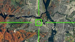
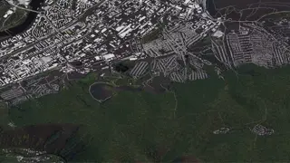
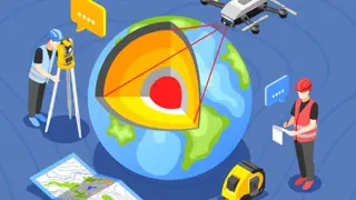
    GIS Remote Sensing in ArcGIS Online Training Do you want to start a career in the GIS sector or learn more about it? In GIS Remote Sensing in ArcGIS, you'll explore the fundamental aspects of GIS. This GIS Remote Sensing in ArcGIS offers a comprehensive overview, ensuring a …
    £12
  • GIS : Remote Sensing in ArcGIS

    Royal Course
    CPD Certified | Update on 2023 | 24/7 Support | Free Digital Certificate | Free Exam | Lifetime Access
    • Online
    • 0.8 hours · Self-paced
    • Certificate(s) included
    • Tutor support
    Great service
    GIS : Remote Sensing in ArcGIS Training Do you wish to start a career in GIS : Remote Sensing in ArcGIS or do you want to get more comprehensive GIS : Remote Sensing in ArcGIS? The GIS : Remote Sensing in ArcGIS course was prepared by specialists with the requirements of job see …
    £12
  • GIS - Remote Sensing in ArcGIS

    Prime Course
    CDP & UKRLP Certified |* Free Instant Certificate *|* Instant Access *| Lifetime Access | 24/7 Tutor Support
    • Online
    • 0.8 hours · Self-paced
    • Certificate(s) included
    • Tutor support
    Great service
    GIS - Remote Sensing in ArcGIS Welcome to GIS - Remote Sensing in ArcGIS, a comprehensive online course designed to provide you with a deep understanding of GIS - Remote Sensing in ArcGIS. Throughout this engaging GIS - Remote Sensing in ArcGIS course, you will explore key concep …
    £12
  • Geographic Information Systems (GIS) Level 3 Advanced Diploma

    Course Line On Demand
    Update on 2024 | CPD Certified | Free Digital Certificate | Free Exam | Lifetime Access | 24/7 Student Support.
    • Online
    • 1.2 hours · Self-paced
    • Certificate(s) included
    • Tutor support
    Great service
    Welcome to Geographic Information Systems (GIS) Level 3 Advanced Diploma, a comprehensive and engaging course designed to provide you with in-depth knowledge and practical skills in GIS. Throughout this course, we will explore various aspects of GIS and delve into its fundamental …
    £12
  • GIS : Remote Sensing in ArcGIS

    Skill Buster
    Learn From Industry Experts | Included Certificate | Instant Access | 24/7 student support | No hidden fees
    • Online
    • 0.8 hours · Self-paced
    • Certificate(s) included
    • Tutor support
    Great service
    GIS : Remote Sensing in ArcGIS Training Have you thought about working with or learning more about GIS : Remote Sensing in ArcGIS? This GIS : Remote Sensing in ArcGIS course was prepared by specialists with the requirements of job seekers and established organisations in …
    £12
  • GIS : Remote Sensing in ArcGIS

    Course Line
    Updated study materials |* Free Certificate *|* Designed by Industry Experts *| Instant Access | 24/7 Support
    • Online
    • 0.8 hours · Self-paced
    • Certificate(s) included
    • Tutor support
    Great service
    GIS : Remote Sensing in ArcGIS Do you want to start a career in the GIS : Remote Sensing in ArcGIS sector or learn more about it? This GIS : Remote Sensing in ArcGIS course is designed by industry experts so that it assists you to have a better understanding of GIS : Remote …
    £12
  • GIS : Remote Sensing in ArcGIS

    Course Line On Demand
    Updated study materials |* Free Certificate *|* Designed by Industry Experts *| Instant Access | 24/7 Support
    • Online
    • 0.8 hours · Self-paced
    • Certificate(s) included
    • Tutor support
    Great service
    Welcome to GIS : Remote Sensing in ArcGIS, a comprehensive and engaging course designed to provide you with in-depth knowledge and practical skills in GIS. Throughout this course, we will explore various aspects of GIS and delve into its fundamental concepts, advanced techniques, …
    £12
  • Geospatial Technology

    Study Booth
    Advanced Learning Materials | Certificate Accredited by CPD | Lifetime Access | 24/7 Expert Tutor Support
    • Online
    • 2.4 hours · Self-paced
    • Certificate(s) included
    • 10 CPD points
    • Tutor support
    Great service
    Journey into the world of ' Geospatial Technology ' and unlock the power of mapping the earth. Discover how to transform data into dynamic maps and visualizations, revealing stories hidden in landscapes. Chart a course to the future, where every coordinate tells a story, and ever …
    £15.99
  • Geography Training Course

    Course Line On Demand
    Updated study materials |* Free Certificate *|* Designed by Industry Experts *| Instant Access | 24/7 Support
    • Online
    • 1.8 hours · Self-paced
    • Certificate(s) included
    • Tutor support
    Great service
    Overview Welcome to Geography Training Course, a comprehensive and engaging course designed to provide you with in-depth knowledge and practical skills in Geography. Throughout this course, we will explore various aspects of Geography and delve into its fundamental concepts, adva …
    £12
  • Cartography and Map Design Level 3 Advanced Diploma

    Course Line On Demand
    Update on 2024 | CPD Certified | Free Digital Certificate | Free Exam | Lifetime Access | 24/7 Student Support.
    • Online
    • 2.3 hours · Self-paced
    • Certificate(s) included
    • Tutor support
    Great service
    Welcome to Cartography and Map Design Level 3 Advanced Diploma, a comprehensive and engaging course designed to provide you with in-depth knowledge and practical skills in Cartography and Map Design. Throughout this course, we will explore various aspects of Cartography and Map D …
    £12

FAQs

Reed Courses advertises a large variety of GIS courses which are delivered by a range of learning providers. The GIS courses on offer vary in time duration and study method, with many offering tutor support. Whether you want to study for a regulated qualification, or take a GIS course which provides CPD points/hours or qualifications, there are a number of learning options available.

If you're looking for GIS courses, you might also be interested in Geography, Cartography and Geotechnical engineering. These courses can be taken to further enhance your understanding of the subject. By having a broader understanding of the subject can help you to improve your professional or personal development.

Yes, Reed Courses has a wide range of free courses in a variety of subject areas. These free courses are a great way to explore a subject you're interested in without a financial commitment. You can find them by visiting the free page.