GIS: Spatial Analysis in ArcGIS
24 Hour Flash Sale : Up to 98% Off | 4 in 1 Exclusive Bundle | PDF Certificate & Test Included
StudyHub
Summary
- Certificate of completion - Free
- Exam(s) / assessment(s) is included in price
- Tutor is available to students
Add to basket or enquire
Overview
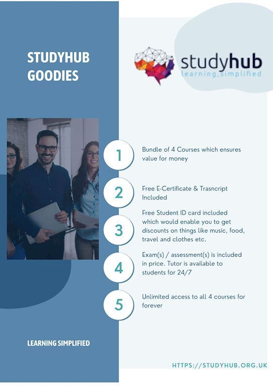
Special Gifts (Additional Courses + Pdf Certificate) Worth £120 - Enrol Now!
Skill Up To Your Dream Job - Enrich Your Life From Home!
**Deal for Today - Comprehensive Bundle of Four Premium Courses & as Bonus you will get Pdf Certificates, Transcripts, Student ID, 24/7 Tutor Support & Exam/ Assessments at a single payment. No Hidden Fees !!**
Kickstart your career & boost your employability by helping you discover your skills, talents and interests with our special GIS: Spatial Analysis in ArcGIS Bundle. You’ll create a pathway to your ideal job as this course is designed to uplift your career in the relevant industry. It provides professional training that employers are looking for in today’s workplaces.
This Bundle consists the following professional career oriented courses:
- Spatial Analysis in ArcGIS
- The Basics of ArcGIS for Hydrology
- Remote Sensing in ArcGIS
- Computer Science with Python Course
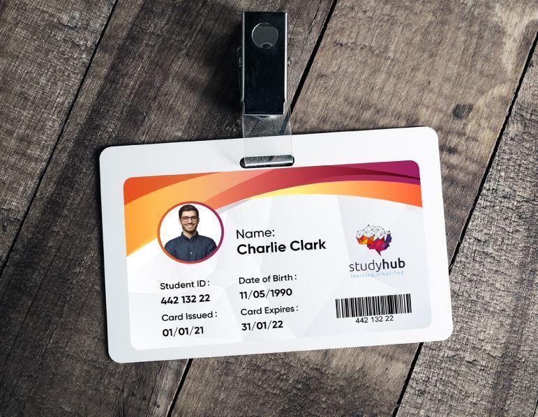
The course is self-paced and can be taken from the comfort of your home, office, or on the go! With our Student ID card you will get discounts on things like music, food, travel and clothes etc.
Why buy this Bundle?
- Unlimited access to all 4 courses for forever
- Absolutely no hidden fees
- Receive one to one assistance on every weekday from professionals
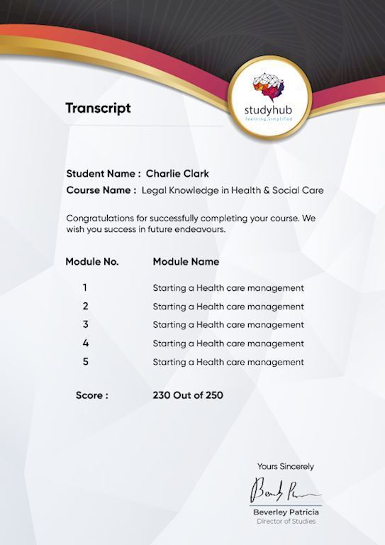
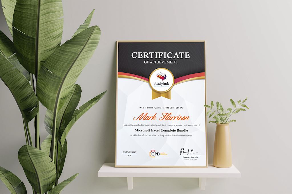
- Immediately receive the PDF certificate after passing
- Receive the original copies of your certificate and transcript on the next working day
- Easily learn the skills and knowledge from the comfort of your home
CPD
Course media


Description
Course Curriculum
- Module 01: Point Density Analysis
- Module 02: Raster Calculator and Vector Isolation
- Module 03: Raster to Topography
- Module 04: Raster Reclassification
- Module 05: Raster Overlay
- Module 06: Slope Analysis and Hydrology tools
- Module 07: Introduction to TIFF Files
- Module 08: Introduction to 3D Surfaces
- Module 09: Satellite Images and TIN Surfaces
- Module 10: Exercise
Certification
Following your completion of the course materials, you will be able to take an assignment test to assess your knowledge. You will be able to grab one PDF certificate for free after passing the test. Original Hard Copy certificates must be bought separately for an extra £8.
Who is this course for?
This course is appropriate for
- Students who have recently graduated and are looking for work.
- Anyone interested in this area
- Those who are already working in related industries and wish to improve their knowledge and skills.
Questions and answers
Currently there are no Q&As for this course. Be the first to ask a question.
Certificates
Certificate of completion
Digital certificate - Included
Reviews
Currently there are no reviews for this course. Be the first to leave a review.
Add to basket or enquire
Course provided by
Legal information
This course is advertised on reed.co.uk by the Course Provider, whose terms and conditions apply. Purchases are made directly from the Course Provider, and as such, content and materials are supplied by the Course Provider directly. Reed is acting as agent and not reseller in relation to this course. Reed's only responsibility is to facilitate your payment for the course. It is your responsibility to review and agree to the Course Provider's terms and conditions and satisfy yourself as to the suitability of the course you intend to purchase. Reed will not have any responsibility for the content of the course and/or associated materials.
